In the age of digital revolution, the world has become intricately interconnected, and understanding spatial data has never been more critical. Enter Geographic Information Systems (GIS) mapping—a transformative technology that has reshaped industries, empowered decision-makers, and unlocked a new dimension of data analysis. In this article, we delve into the realm of GIS mapping, exploring its applications, benefits, and the profound impact it has on various sectors.
Unveiling GIS Mapping: A Digital Cartographic Marvel
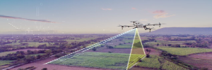
GIS mapping is the process of capturing, storing, analyzing, and presenting geographical data digitally. Unlike traditional paper maps, GIS maps offer dynamic, interactive, and multi-layered representations of spatial information. At the heart of GIS mapping lies the integration of data from various sources, including satellite imagery, aerial photographs, GPS, and socio-economic datasets, enabling users to gain insights, make informed decisions, and solve complex spatial problems.
Applications Across Diverse Sectors
Urban Planning and Development: Urban planners utilize GIS mapping to analyze population distribution, land use patterns, infrastructure development, and environmental factors. By visualizing data on a map, city planners can optimize resource allocation, design efficient transportation networks, and create sustainable urban environments.
Environmental Management: GIS mapping plays a pivotal role in environmental conservation efforts by monitoring deforestation, tracking wildlife habitats, and assessing the impact of climate change. Conservationists leverage GIS technology to identify ecologically sensitive areas, plan protected zones, and mitigate natural disasters.
Public Health: In the realm of public health, GIS mapping is employed for disease surveillance, epidemiological research, and healthcare planning. By mapping the spread of infectious diseases or identifying healthcare disparities based on geographic location, policymakers can allocate resources effectively and implement targeted interventions.
Disaster Management: During natural disasters such as hurricanes, earthquakes, or wildfires, GIS mapping provides real-time situational awareness, aiding emergency responders in rescue operations, evacuation planning, and damage assessment. By overlaying hazard maps with demographic data, authorities can prioritize vulnerable communities and enhance disaster preparedness.
Business Intelligence: In the business world, GIS mapping enables companies to analyze market demographics, identify potential locations for expansion, and optimize supply chain logistics. Retailers can visualize customer distribution patterns to optimize store locations, while logistics companies can streamline delivery routes to minimize costs and maximize efficiency.
Unlocking the Power of Spatial Analysis
The true strength of GIS mapping lies in its ability to perform spatial analysis, allowing users to derive meaningful insights from geographical data. Spatial analysis techniques include proximity analysis, spatial interpolation, network analysis, and spatial clustering, among others. Whether it's identifying hotspots of crime activity, modeling the spread of pollutants, or optimizing wildlife corridors, spatial analysis empowers users to extract actionable intelligence from spatial datasets.
Embracing the Future of GIS Mapping
As technology continues to evolve, the future of GIS mapping holds immense promise. Advancements in remote sensing, artificial intelligence, and cloud computing are revolutionizing the way spatial data is collected, processed, and analyzed. From autonomous vehicles using GIS for navigation to smart cities leveraging real-time data for urban management, the applications of GIS mapping are boundless.
The Dawn of Satellite Mapping
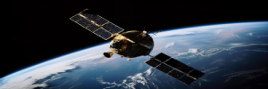
The inception of satellite mapping can be traced back to the mid-20th century when humanity launched its first artificial satellites into orbit. These technological marvels not only expanded our reach beyond the confines of Earth but also provided a novel perspective on our planet's surface. With the advent of satellite imaging technology, the dream of mapping the Earth from space became a reality, giving rise to a new era of cartography.
Harnessing the Power of Satellites
At the heart of satellite mapping lies a constellation of orbiting satellites equipped with advanced sensors capable of capturing high-resolution imagery across the electromagnetic spectrum. From optical cameras to synthetic aperture radar (SAR) systems, these satellites collect data with unparalleled precision and detail. By stitching together these images and employing sophisticated algorithms, satellite mapping platforms can generate comprehensive maps that offer insights into terrain, vegetation, land use, and more.

Applications Across Industries
The applications of satellite mapping are as diverse as they are impactful. In urban planning and development, satellite imagery provides invaluable insights into infrastructure, population distribution, and environmental factors, enabling authorities to make informed decisions about resource allocation and growth management. Similarly, in agriculture, satellite mapping aids in crop monitoring, soil analysis, and yield prediction, empowering farmers to optimize productivity while minimizing environmental impact.
Furthermore, satellite mapping plays a pivotal role in disaster management and response efforts. In the aftermath of natural calamities such as hurricanes, earthquakes, or wildfires, satellite imagery provides emergency responders with real-time situational awareness, facilitating swift and targeted interventions. Additionally, satellite mapping contributes to environmental conservation by monitoring deforestation, tracking wildlife habitats, and assessing the impact of climate change on ecosystems.
Empowering Global Connectivity
One of the most profound implications of satellite mapping is its role in fostering global connectivity. By providing accurate geospatial data, satellite mapping enables digital navigation services that have become indispensable in our daily lives. Whether it's finding the shortest route to our destination, locating points of interest, or visualizing geographic information in augmented reality applications, satellite mapping has revolutionized how we interact with the world around us.
Challenges and Future Frontiers
Despite its remarkable capabilities, satellite mapping is not without its challenges. Issues such as cloud cover, atmospheric interference, and data processing limitations can hinder the accuracy and timeliness of satellite imagery. Moreover, privacy concerns and geopolitical tensions surrounding access to satellite data underscore the need for ethical and transparent governance frameworks.
Looking ahead, the future of satellite mapping holds immense promise. Advancements in satellite technology, including the deployment of next-generation satellites with enhanced capabilities, as well as the integration of artificial intelligence and machine learning algorithms, will further refine and expand the applications of satellite mapping. From monitoring urban growth to tracking environmental changes on a global scale, satellite mapping will continue to be at the forefront of innovation, offering new perspectives and insights that redefine our understanding of the world we inhabit.
For More Info:-
3d lidar
lidar
lidar data classification
GIS
gis mapping
maps in gis
gis maps
gis map
GIS Services
gis 3d modelling
Digital Mapping
satellite mapping
LULC
land use land cover
land cover mapping
Land subsidense mapping
Aerial Triangulation
aerial triangulation in photogrammetry
aerodrome mapping database
aerodrome mapping
aerodrome maps
AMDB


